During the next days I will get into lush forests and then again cross colourful volcanic landscape around Volcan Chillan.
The night is chilly and I get a bad sleep. Even in the morning I wear fleece and gloves! The descent from the pass is quite steep and soon I follow the Estero Moralito downwards.
I photograph a beautiful small falcon in a tree, who is not shy at all.
Estero Moralito
Where this creek flows into Rio Gonzalez, real forests starts. Although I like the open spaces it feels good to be back under the trees.
I pass a large puesto with some fenced pastures. For the first time since Los Quenes there are gates to open... The good trail meanders between forest and more open land.
View into the Rio Gonzalez valley
When two riders pass by, it turns out that I saw their camp at the southeastern bay of Lago Dial. They are from Chile and spent some days fishing at the beautiful lake.
Two Chilenos return from fishing
In the afternoon I walk close to the river in a gorge with clear water and many small fishes. While first I wade the river barefoot at the frequent crossings, I soon leave my shoes on. It happens just too often that I need to change the side...
Frequent crossings of Rio Gonzalez
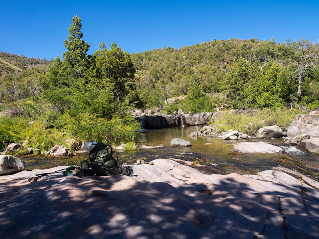
Later the river enters a spectacular gorge with black and purple rocks. Very beautiful!
Beautiful gorge
When I want to photograph a crossing, disaster strikes: I mount the camera on my tripod close to the rivers edge. When I just start walking into the river, the construction tumbles and my camera lies in the water! Oh no! I grab it very quick and to my relieve it seems like everything is o.k, big luck!
Almost disastrous crossing...
In some stretches the path is quite narrow traversing the scree slopes above the river.
Interesting trail
It is so beautiful here, that I put up my camp in a shady cypress grove quite early. Here at 1088 meters it is quite hot and I don't need to worry that the night will again be cold...
Camp in cypress grove
When later I go for a walk I find the gorge even more beautiful in the clear evening light.
Rio Rodriguez in evening light
It takes only an hour next morning, when the valley becomes broad. There is a large, rather permanent puesto with pigs and chicken around the house. Here Estero Las Tragedias flows into Rio Rodriguez. The creek is easily crossed on a bridge, something rare so far on the GPT!
I cross Estero Las Tragedias on a bridge
Soon after reaching the other side, the trail to Las Truchas, my next destination, leaves the main route of the Greater Patagonian Trail.
On a good horse track I ascent the Las Tragedias valley. When I reach another puesto the dog barks, but doesn't react aggressively. A woman explains how the trail continues. It seems that now in the morning, the whole family is watching solar powered TV inside their hut...
 |
| Ascending Estero Las Tragedias |
Unfortunately the lense of my camera, of which I thougt nothing happened when dropping into the river yesterday, now is fogged, although I immediately dried it in the sun...
Luckily after some time it is clear again, puh....
The trail gets increasingly faint, and at one point I loose it, and walk trackless towards the river, where I find a nice rocky spot, with small waterfalls. Soon I am on the trail again!
Nice, rocky spot on the river
Leaving Estero Las Tragedias
I leave the River and ascent steeply across dense forest on a faint trail. When I reach a grassy bowl the terrain becomes open, although there are some thick Nirre stands.
View back into Estero las Tragedias
Dense Nirre
I ascend further towards a mountain chain, but there is no trail leading to a pass. At some grassy patches with water and cattle the trail ends, but still no path to the other side of the mountains is visible.
Walking towards a mountain chain
View to the trailless pass
I stay on the GPS- track and traverse rocky slopes towards a notch what must be the pass. Finally I start the steep ascent. It is longer as I thought...
At about four o'clock in the afternoon I have reached the pass at 2216 meters.
Across dense scrub
After passing an old fence the trail becomes increasingly better and soon I am in real beautiful forest. Laguna Las Truchas can't be very far, but it is already quite late, therefore I pitch my tent in the forest. It is quite mild down here and I enjoy to be again among the trees. Another beautiful day with little adventures when ascending and descending the pass comes to an end.
Forest camp
In the morning I watch some brown, thrush like forest chicken, who make noises like squirrels near camp. Soon the sun rises and another beautiful day envelops.
Sunrise near Las Truchas
After one and a half hour of quite steep descent, I spot Laguna Las Truchas below me.
Laguna Las Truchas
A little later I am at the shore of the beautiful Lagoon. While this side is forested, waterfalls are tumbling down the steep cliffs on the other shore. A sign says " No hunting and fishing here" and there is even a boat secured. Probably this is a nice hideaway for the owner family, who doesn't want to be disturbed. There are quite a lot of dark ducks and even some parakeets in the trees. Nearby is the smaller Lagunilla Las Truchas which I find even more beautiful.
Lagunilla Las Truchas
I cross some open terrain, before the clear path dives into the forest.
Descent from Las Truchas
A well worn trail leads in the forest, where I find a nice looking log house, the domicile of the property owners?
Well worn trail in the forest
A little later I arrive at a puesto, where a woman around 40 is working in the small garden. Angela greets very friendly and invites me to have breakfast with her. I sit down on the fireplace outside, where she prepares tea and even eggs, very nice!
Apart of Angela her 5- year old son Manuel is around. The family lives here from december to may and mainly her husband looks after 100 cattle and 30 horses who live on Las Truchas. Their patron seems to be friendly and good, they work here already since 17 years. While the summers are regularly warm and dry, this year was the first time that they had 42 degrees Celsius! There are Guanacos and even Pumas around, but seldom seen. They say that they don't shoot the Pumas, but especially the settlers who own goats are chasing them. It is a very idyllic place at the edge of forest and a large pasture and Angela loves it! They don't have electricity and only a gas lantern for light.
Although I saw the signs and know that trespassing here is illegal, Angela explains that this is just because some Chilenos misbehaved in the past. Hikers who leave only footprints are welcome!
I got invited at Angelas Puesto
When I am already on the move again, Angelas husband and two other arrieros come thundering down a steep mountain slope on their horses. Cowboy life is alive!
Las Truchas seem to be well kept, there are large fenced pastures and the cattle is healthy.
Open pastures
Well guarded, but no problem for hikers
I cross the Rio Las Truchas near another puesto and soon after the river descends in a gorge. I hike on a good trail above the Rio. For the first time the snow capped silhouette of Volcan Nevado Chillan comes into view, my next destination!
Descending Rio Las Truchas
I get to a shady side creek with majestic coigues, some picnic tables and even a bridge!
Shady side creek
Unexpected bridge
The path then climbs again a bit and stays above the river valley. I meet two other pedestrians, camouflauged hunters with guns and fishing rods!
High above the river
Finally the trail moves away from the river and I spot the broad valley of Rio Nobles. A steep descent leads to the valley floor, where Coironal is situated, a 12-house village, the first settlement on this leg of my hike!
Coironal and the valley of Rio Nubles
At the valley floor there is a gate and signs "private property, no hunting, no trespassing"...
I don't walk into the small village, instead I follow a sandy jeep track in low forest up the valley.
Jeep track in Rio Nubles valley
Here I am back on the main route of the Greater Patagonian trail and after some kilometers I find a camping spot with a creek nearby , that obviously was used before.
Like the day started it ends with a beautiful red sky...
Sunset in Rio Nubles valley
While it is still almost dark I start again on the dirt track. The easy walking is one of the few advantages of otherwise boring road hiking...
Early morning road walking
Now the road passes high above Rio Nubles, which flows in a tight gorge. I meet the first and only car. The passengers greet me enthusiastically when I walk by. At a large place there is a cable car, which leads to a farm on the other side of the river.
Rio Nubles Gorge
Already at about 9 in the morning a faint path branches to the right and leads quickly to a tributary of Rio Nubles which looks rather deep and swift so I leave my trailrunning shoes on. But in reality the crossing is quite easy.
Wading of a side creek
On the other side the trail becomes faint and overgrown. Often I have to search a bit where it goes on further. The GPS is a real help for this...
At a large, open scrubby hillside the walking on the overgrown track becomes even more difficult, but at least I get a nice view back to the Rio Nubles valley.
View back into Rio Nubles valley
After traversing the slope I descend into the valley of Estero Quebrada which I follow upwards. Although the road is not far, this feels like wilderness with majestic forest and hardly visible cow trails. Only a hand full of cattle make their living in bamboo and forest.
Only a few cows live at Estero Quebrada
Suddenly I hear a quaking voice and spot a pair of huge, beautiful Magellan woodpeckers at work in the trees. They are not very shy so I can get a number of pictures. While the female is all black the males head is red. With their size and colours they resemble a bit the european black woodpecker and it seems like they really belong to this virgin forest with huge Coigue trees who measure more than two meters in diameter.
Beautiful Magellan Woodpeckers
Some little creeks form nice waterfalls with lush vegetation. I especially like the Fuchsias which I already know from my first chilean trip.
Lush creek vegetation
Nice waterfalls
Fuchsias
Huge Coigue trees
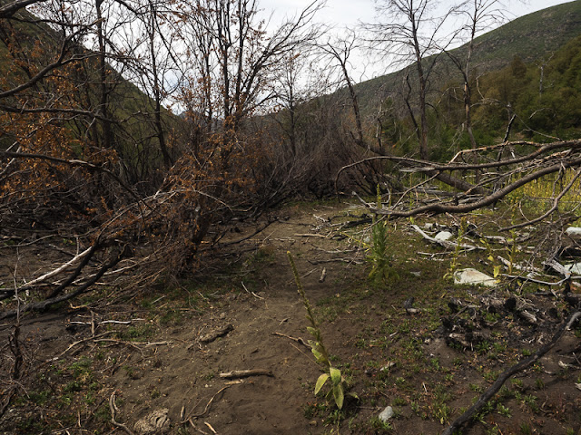
Above 1400 meters the forest becomes smaller and soon the Nirre scrub dominates. There are some recently burnt patches and again a trail is almost nonexistent.
Recently burned
Dense Nirre scrub
I pitch camp rather early at about 1600 meters because higher up the night will be cold again and probably I won't find fuel for my wood stove.
After having dinner I try to find the trail upwards. Although there are some cow tracks it is mostly connecting the open spots in the scrub.
The upper reaches of Estero Quebrada
The beginning in the morning is less difficult as I thought. Soon I reach the spot to where I walked in the evening. From there it is only a bit more in the Nirre, than the ascent is quite clear.
View back into Estero Quebrada
At about 9 in the morning I reach a pass at 1970 meters. The views towards the multicoloured massiv of Volcan Chillan in the crisp morning air are stunning.
View from pass 1970 m towards Volcan Chillan
Jan has plotted the descent as trackless but for the most time a track is visible. I reach Rio Las Minas which I cross, follow the creek for a while and then ascent again to the next pass. Once again I enjoy the beautiful, multicoloured landscape. To my surprise there are footprints in the sand, something very rare on the GPT!
Are there other long distance hikers?
Footprints in the sand
View from the next pass
After a short descent I reach the rather flat Valle de Aguas calientes, the hot springs valley. The numerous cattle who live here keep the grass short like in an english park, it must be some kind of paradise for them. But of cause, the real speciality are the hot springs. Immediately after the descent I reach a very fine one, with a little waterfall of hot water, and a very nice pool, which has the perfect bathtub temperature! When you dip in, your body relaxes, and the beautiful surrounding make for an almost meditative atmosphere. Rather hard to continue after this nice experience!
Cow paradise
A perfect hot spring
Down the valley are more of these relaxing spots, and some of the streams are so hot, that it is impossible to cross them barefoot, but a little further down, the water has cooled down already. There are some people who set up tents and have a good time. Two geologists arrived here on horseback. I hope their findings will not lead to the destruction of this fantastic valley by some economic development...
A steep, apparently well used trail leads to a pass at 2400 metres, from where the ascent to the top of Volcan Chillan, (3186 m) starts.
The views are incredible!
View back into Valle de Aguas Calientes
The next stage towards Volcan Antuco
Incredible view
Instead of climbing the volcano, I descent on a steep path towards the resort Termas de Chillan.
Descent from the pass
Steaming fumaroles on the way down
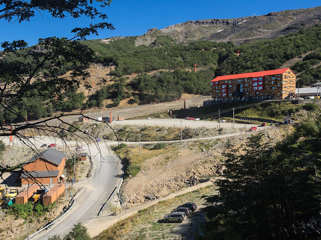
Further down I meet some dayhikers and even mountain bikers. At the road there is a large aquapark and it is clear that this is a well known skiing destination as well.
Termas de Chillan
From Siete Tazas to here I took 19 days, in which I hiked 364 kilometres. I can already tell, that this remote stage with high colourful mountain deserts, beautiful lakes and lush forests was a highlight of this trek. I especially liked the feeling of exploring wide open spaces near the border to Argentina! Although a bit challenging, the hiking on the horse trails is very interesting compared to walking on broad vehicle tracks!
I learn that there is no bus this afternoon, but hitchhiking the 90 kilometres to the town of Chillan turns out to be easy and I am surprised about the number of touristic facilities in the Valle de las Trancas which leads out of the Andes.
In Chillan I take a rest day to resupply, wash my clothes, having showers and most important of all: Eat a lot!


Keine Kommentare:
Kommentar veröffentlichen