
I had intended to explore more of the granite country around Hellemofjord but next morning I soon must realise, that that is a slow, difficult undertaking. I would run out of food and more importantly miss an appointment in some days, so I decide to turn back on the Nordkalottleden.
Near the excavation site I meet Mr. Aronsson again. He is not only an experienced arctic scientist, but half Sami as well, so this is the chance to learn more about these indigenous people.
As I already know, nowadays wild reindeer live only in the mountains of southern Norway. Up to short ago, it was believed, that in the north they were tamed by the Sami, so that their herds are descendants of the original wild ones. But recent genetic science has found out, that the Sami already took their reindeer with them, when they immigrated from the east. Around 1800 they had extinct the wild reindeer.
The Sami language is related to finnish, so both groups originated in todays Russia. But there are elements in the language of the Sami which are different, a hint to the people who lived in the area before the Sami arrived.
Unlike Norway, Sweden is much more tolerant to large predators. I express to Mr. Aronsson that I doubt that this plays a big role for the Sami, when they need to protect their herds, but he insists that in fact in Swedish Sapmi the number of bears and wolves has significantly increased. There are areas where 50 % of the reindeer calves are lost to the bears in spring.
A not so obvious question with big implications is, who is regarded by the swedish government as Sami. In the past there where language tests, but nowadays the government only gives Sami rights to people who own reindeer. As there always had been a large percentage of Sami who just hunted and fished, their descendants are nowadays disclosed from the exclusive land use rights of ackknowledged sami, which is especially important for hunting. This feels to be unfair, but on the other hand, today the biggest number of Sami lives in the respective capitals of their countries. To extent exclusive hunting rights on them would surely mean a depletion of wildlife...
After we have talked again, I continue my hike, full of thoughts about what I have learned during the two encounters with the scientists.
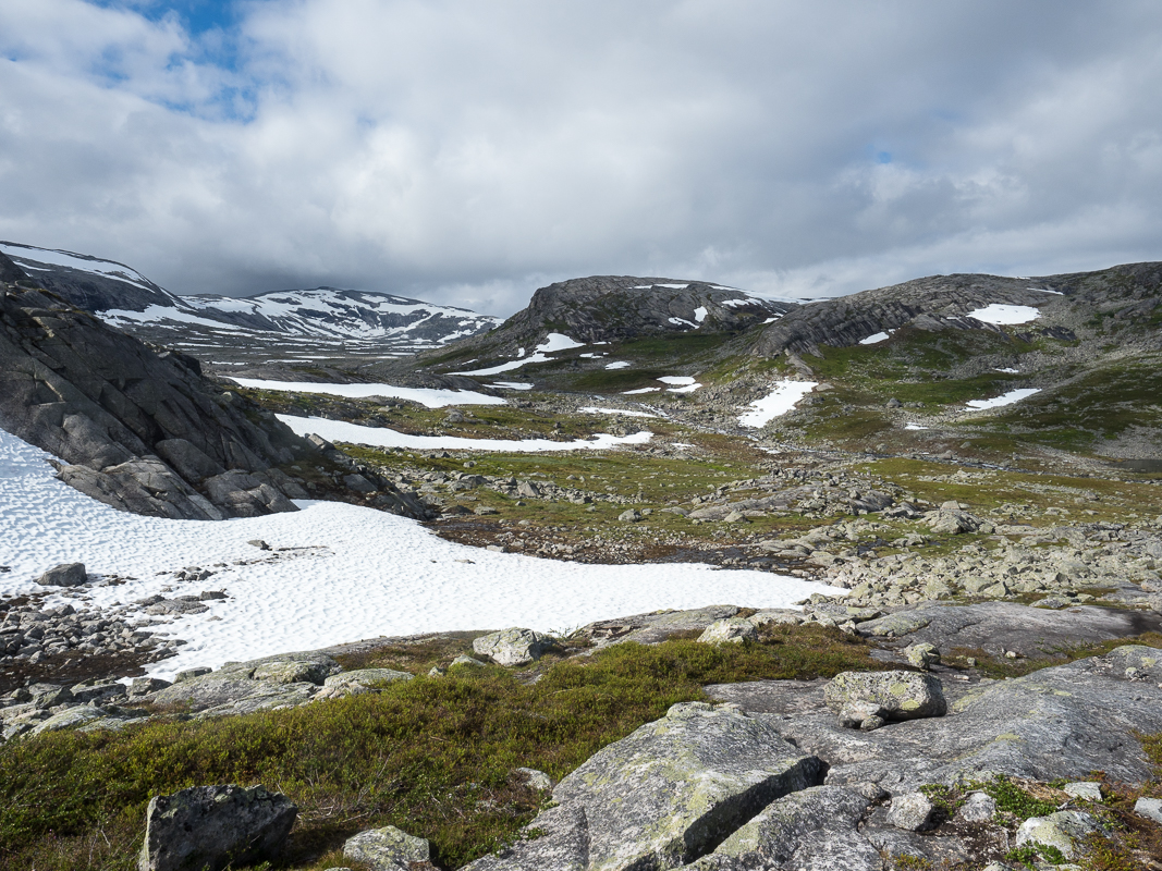
Back on the trail I see nobody for a long time, so I am quite surprised when I meet a lone hiker. Kaja from Oslo has started her hike at Nordkapp and wants to reach Kap Lindesnes, Norway's most southern point. She found the last days on the trail very tough and is happy to meet me, the first human of today...
Kaja is a professional photographer and blogs about her hike.

Here back in Norway, there is still a lot of snow, quite a contrast to the gentler landscapes in Sweden! Inspired by my encounters I think a lot about my life and plans for the future. One thing is very sure: I will continue my long hikes! But I also would like to share more, not only of my personal experience, but to a higher degree add a broader dimension, especially on things related to the land.

Next morning I start in sun again. Today I have to cover a lot of altitude difference, because the pattern is climbing up to a ridge and descending into a valley, which repeats several times. When I get to a wilder river, I know this is the place I have already heard about. Supposedly other hikers turned back here, because they couldn't cross. And indeed, at the first two places I want to wade the river, I need to step back, because the current is too fast. So I hike a little distance upstream where I find a calm spot above a rapid. Here the water is thigh deep, but the crossing poses no problem. The lesson is, that even when a river seems to be unfordable, with a little scouting it is often possible to find an adequate place.


The Nordkalottleden apparently doesn't get much use here, in parts the trail is badly marked and hardly visible, quite unusual in Norway!
Around noon I reach Roysvatn which at 800 meters altitude is still fully frozen! The hut buildings are on a thawed patch in the white wilderness.

The trail changes the side of the border here frequently and a long descent down a snowy valley gets me again into a greener landscape.

The weather has changed, for a long time a steady rain is falling, so I am glad when I pitch camp after this long, quite hard day.
On the grey morning the temperature reaches just 6 C°, mist adds a mystical atmosphere to the large Bavrojavre, which I follow for a long time, but mostly away from shore. Although there is a lot of snow, fortunately it is quite compact and easy to walk.

When I meet a swiss couple, they tell me, that one of the rowing boats, which are used to cross a 50 meter part of the lake to reach Paurohytta is missing. When they arrived on the shore from the north, the boat was lying on the other side, so they had two options: Do a 9 kilometer trackless, strenous detour around the lake, or swim across. While the guy understandably hesitated to swim a quite long distance in a lake with icebergs sailing, his brave girl friend stripped, swam the 50 meters and rowed the boat back!
I wouldn't have done that, but am glad that the boat now is on the right side for my crossing....
 |
| A swiss girl swam across that ice cold lake to get the boat!
From Paurohytta, where I have my chocolate break, I gain again altitude to reach a pass. The route down is quite steep and at one snowfield I manage to slip and slide down some meters. Fortunately not too far, so nothing serious happens, only my left arm hurts a bit...
I cook my dinner at the tiny, free Baugebu hut and then continue along large thawing Baugevatnet. At Baugebu I had met a norwegian couple, the man complaining about an incident damaging his foot. While I follow the shore, I get to the spot where this mishap occured. The snow here is rotten and he broke in a deep hole, where he hurt himself by the rocks...

Globeflowers and melting ice on Baugevatnet

Camp with a view across Baugevatnet
Next morning I soon reach a Tundra plateau above the lake. While it is cold and grey, some sunrays add a magical atmosphere.   Unfortunately a ugly powerline runs down the valley to Sitasjaure. Like so many areas in the norwegian mountains, the use of waterpower is excessive here, with tunnels channeling the water and service roads.   From Sitasjaure I need to follow a gravel road for quite a long time. Fast walking, but very unexpected on the Nordkalottleden. Is there really no better trail alternative? I meet Vera from Augsburg. She is just 19 years old, and is about to hike the whole Nordkalottleden, 800 kilometers from north to south! This is her first time in the north and the first long trek either, chapeau to her braveness! Although certainly doable even for a beginner, I imagine that she has chosen quite a challenge. I like it very much to meet such young courageous people who develop their passion for nature and hiking. This is surely addictive! A steady rain is falling on this grey day, so the steep hike out of the valley across the slippery granite slabs is quite difficult. Here the red markings often don't show the safest way, so a bit of routefinding is needed. When I have reached a plateau it seems like the clouds are lifting, but this is only for a short time, then the rain pours down again even with more force...  As I am already quite wet, I am glad when at 7:30 pm I reach the Skoardejavri hut. Like usual there are different buildings and I have a small hut to myself. Drying out my clothes...   It rains a lot in the night, and the next morning is grey with the temperature around 2 C°, a bad late November day in Germany? No this is August in northern Norway... I climb up to more than 1100 meters so I am surprised, that not much snow is left, although it has thawed just recently... The Nordkalottleden continues towards Gautelis hut, so I think, I won't meet many people on my route... Around noon it starts raining again and as a hard wind is blowing, I can't use my umbrella.  I think the walking across the slippery boulder fields is quite hard, so I feel relieved when I get near to the pass, but unfortunately the descent is much more difficult. It is very easy to slip and get hurt seriously here, therefore I walk highly concentrated on every step, which is awfully slow...   
The wind has swollen to a real storm, so I am very happy that I don't need to pitch my tent under these difficult conditions. When I reach the Cainavaggi huts, I have again a building to myself. Late in the evening, Samuel, a young german hiker arrives, with whom I share hiking experiences.
 Next day the weather is much friendlier, and there is even sun! As I leave the mountains, the area gets greener, and the valleys become broad, almost "Alaska-like".  I pass Cunajavri hut, and enter Sweden again. At the Unna Allakas hut I had hoped to buy some food, but the warden in charge is out, hiking... As in Padjelanta, again I like the wider and greener landscapes on this side of the border more!  |
I pass an old copper mine, ascent to a pass at around 1000 meters and finally get to an open hut, two Swedish hikers recommended to me. It is less cozy than the cabins in Saltfjellet, but o.k

I leave early on a clear, cold morning, because I need to reach the road at Kjatterat today. The snow along a lake is hard from the frost, and makes for a perfect ramp if somebody enjoys an ice cold swim, but I prefer to be cautious...

Like so often on this hike, under the thin surface of the snow, there are big holes, with ankle threatening rocks...

Under the clear sky the walking again is a delight, even though the stretches of granite boulder fields are not so easy to negotiate.

When I reach the large Kattajaure, I know it is not very far any more. The track gets better and improves finally to a dirt road.

I had intended to take the train from Kjatterat to Narvik, but as there is no train today, I take the bus. But before I enjoy chocolate from the supermarket....
I urgently need some replacements, like for my torn trouser, and then I will meet Jana, and we will spent a week together, mainly exploring the island Senja, before I continue walking.

Keine Kommentare:
Kommentar veröffentlichen