Translate

11.04.2018

Scandinavian wilderness hike 10- towards Umbukta


On this stage I experience a period of nice weather while walking in the Okstindan area, a not well known, but very beautiful region.

When leaving Hattfjelldal I walk along road 73 towards Sweden. As I don't like roadwalking too much, I am happy when a car stops and the driver takes me to Krutvatnet, where hiking trails start again. We have a lively conversation, which I find quite interesting, because my host occasionally works with Sami people. A family needs about 500 reindeer to make a living. This year they had problems with bears, feeding on their animals, so two of them got shot. In my view this is sad, because big predators like bears and wolves belong to these wild landscapes, but on the other side, it is understandable as well that the reindeer herders don't like to get their stock eaten...
I leave the car at Krutvatnet, where a sign gives some information about the Nordlandsruta which I will follow for some time, a 550 km long distance trail from the Narvik area to Børgefjell, which is not well known.

           Nordlandsruta- an almost forgotten long distance trail

Along the lake is a good number of weekend homes, swampy parts are conveniently bridged!
Some willow grouse chicks are hiding in the grass, only one of them stays on the planks, cheeping for her mother, which seems not to be afraid, looking after her young child, only five meters away from me!


                               Willow Grouse chick    


                           The mother is not afraid of me

At the end of the weekend home area, there is a nice, free to use hut, belonging to the Norwegian forest service statskog, but of cause, it is far to early for me to stay...

Away from Krutsvatnet I cross birch forests before I get on the open, green tundra. The blue and white markings of the Nordlandsruta are still visible, but quite faint...


                             Above Krutvatnet

First I spot one sea eagle in the sky, but then, shortly after another four of them, are starting from the ground, flying away from me! What a majestic sight, but surely I am too slow to get a picture...
Getting to the spot where they had been, I find a dead reindeer. Obviously they were feeding on it, vulture style! I didn't know before, that sea eagles have this habit, but that was exciting!
I am sure, that an eagle is not capable to kill an adult reindeer, so probably its death had another cause.


              Five sea eagles were feeding on the reindeer carcass


When I descent into a valley, I follow a gravel road for some time. There is no traffic, besides a car, with two kayaks on top. The Norwegian driver stops, and it turns out, that in 2003 he walked Norge på langs with a friend! Nice to meet somebody to share experiences!
Finally I leave the road and ascent into the birch forest. It is a mild evening and I enjoy sitting outside and cooking.
Next morning there is not one single cloud in the sky and the temperature is already 9 C°!
I follow a valley with some small lakes and then ascent to a pass. Like usual there are good trail markings, but not a real trail. The hiking areas in Norway south of the arctic circle just get little use...
On the pass beautiful vistas open:   The glacier covered massif of Okstindan appears to be very near, hosting northern Norway's highest peak with 1916 m altitude. Many flowers add colour to the landscape and finally the green of spring has definitely arrived, o.k probably on July 20, it must be called summer, but it feels and looks more like spring...


                                              Okstindan!

I especially like the open birch forests in the valleys, with occasional rowan trees, sometimes stripped of their bark by moose, up to 3 meters!


                     Moose peeled off the bark of Rowan trees

In wet areas the white of the cotton grass adds another accent.


                                 Cottongrass

The snow covered mountains rising above the large Rossvatnet are another beautiful sight.


Rossvatnet

When I descend to Storelva I cross a lush birchforest full of ferns and flowers, thanks to the rich limestone soil.
With sunshine and high temperatures an unexpected disturbance has arrived: Lots of horseflies! But fortunately they seem to be more interested on my smelling socks than on me...

                                 Lush birch forest

                                            Horseflies

The suspension bridge across Storelva is quite interesting, of cause not dangerous, but I could imagine that the shaking bridge high above the river is not for everyone....

                             Suspension bridge at Storelva

After a brief visit to Rossvatnet I climb up to the very beautiful Spettfjelldalen with moorland, birches and a meandering river. The views across the valley to Rossvatnet and the Okstindan massif are breathtaking!

                                    View across Spettfjelldalen

The trail is well marked, but one creek crossing could be rather difficult at high water levels, but pose no problem today.
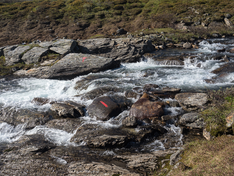
                           Wading the wild creek

Usually I cook dinner, when in camp, but today the weather is so beautiful, that I take a long break to cook on the river and enjoy the warm sun. As most of the time, so far, I have eaten in the tent, this feels very good. Sun and warmth are really nice!

                                       Evening dinner en route

While I am eating, I meet the first hikers since Dovrefjell! Marit and her teenage kids are doing a weekend trip. 
As it turns out, that Marit is the tourism manager of the region we chat for quite a while. 
Okskoltan, the highest peak of northern Norway was first climbed in 1883 by a frenchman and his sami guide. To celebrate this, in 2014 a new hut named Rebeaux after the guy who climbed it first, was opened on Okskoltan. The area is very beautiful, but so far receives only few tourists. Probably I like it like this....

                                        Norwegian weekend hikers

I walk to a Kota, where it is possible to sleep for free, but the interior is a bit grubby, so I prefer to camp.
Next morning I continue in Spettfjelldalen and reach the large Gressvatnet, where a DNT- Hut is located. Marit who slept there with her kids, invites me for coffee, and we chat another 2,5 hours, very interesting!
For some time I follow the rocky shore of the artificial lake.


                                            Near Gressvatnet

Again, it is a perfect, warm and beautiful day, the nice side of Norway...
And although I wear a T-Shirt all day, the northern wind keeps the insects at bay...

                                           The yellow of the Globeflowers 

                               
In the evening after having a dinner break, I cross a fantastic, rugged granite landscape.

                                                Granite dominates the area

When around eight in the evening I reach tiny Grasfjellkoia, the temperature is still 17 C°!
The cabin is owned by the Rana Turistforening and has everything what a hiker needs, but none of the super luxury stuff many other Norwegian huts have. Stove, table, wooden bench. Perfect! Of cause, in this beautiful weather there is no need to sleep in the hut, but it is so cozy, that I can't resist! In the guestbook I read the writing of a german woman, hiking across Norway. It is heard to believe, but  some months later I will meet her in Patagonia!


                                                                  Grasfjellkoia

It is such a calm, and beautiful evening, that soon I am off for a leisurely stroll! A lot of small birds are around, all of them busy to feed their hungry offspring!


                                  Around Grasfjellkoia

                                                         Beautiful evening     

It is unbelievable, the nice weather continues! When I start at 6:30 it is already 12 C°! Soon I walk in T-Shirt again. The terrain is quite difficult with a lot of ups and downs while I walk above the large Grunnvatnet. 


                                Another fantastic hiking day

Before I reach Umbukta I meet father and daughter from Sweden, just having started the second part of their Norge på langs trek.
Umbukta, is somewhat important to the hikers crossing the length of Norway, as it marks the middle of the distance! There is a small hotel and restaurant, which has the reputation of being kind to hikers. Norge på langs wanderers are allowed to stay there for free one night long. I don't intend to stay, but have lunch, in hope of meeting the legendary owner Thor- Inge, who has already completed Norge på langs two times. Unfortunately he is not present, but anyway, the food is good and a nice change to my usual diet...

                                                  Umbukta Fjellstue


13.12.2017

Scandinavian wilderness hike 9- Børgefjell


My next destination is the Børgefjell, another wild Nationalpark with hardly any infrastructure that is sometimes compared to the better known swedish Sarek. Sarek is often termed "Europe's last wilderness" so I am looking forward to what Børgefjell has to offer.

09.12.2017

Scandinavian wilderness hike 8- Across the wild Blåfjella-Skjaekerfjella


Blåfjella-Skjaekerfjella Nationalpark is with more than 1900 sqkm one of Norways largest, but contrary to areas like Hardangervidda touristically quite unknown. Although the area of the park is not that large, it feels giant because it forms a large corridor along the Swedish border. There are only few hiking trails and huts and the landscape of dense primeval spruce forests, wide fjells and moors and distinct peaks is very varied.  Two isolated farms, quite unique in Norway, emphasize the wild, remote character of the park which was founded only in 2004.

28.11.2017

Scandinavian wilderness hike 6- Knutshøa and Forollhogna


Here at Kongsvold in Drivdalen I will leave the network of marked DNT- hiking trails for a long time, to explore the lesser known landscapes of central Norway. I will use a mixture of cross country walking, local trails and occasional dirt roads. Dovre Fjell on the western side of the valley, was the last of the high mountain chains I crossed. The landscape I will hike through might be less spectacular because there are no more glaciers and rugged rocky mountains, but as I like wide open spaces and the adventure of trailless walking, I am looking forward towards the next stages of my hike....

21.11.2017

Scandinavian wilderness hike 5- Dovrefjell, Home of the Muskox


Next morning I have soon reached the treeline and the gradient eases. Here I am on the  1500 sqkm large  high plateau auf Dovrefjell. Although a good number of peaks stand out of the plain and reaches heights of more than 2000 meters, there are only relatively tiny glaciated areas, unlike Reinheimen and Breheimen further southwest. The explanation is, that Dovrefjell in the lee of these other mountains receives relatively little precipitation. Once again therefore I hope finally to be out of the snow...

17.11.2017

Scandinavian wilderness hike 4- across Breheimen and Reinheimen

It has rained all night and I am grateful, that there is a bridge across the wild Utla River, which would be impossible to wade...


                                                                           Utla

04.11.2017

Scandinavian wilderness hike 3- from Skarvheimen to Jotunheimen


When next morning I get to the train station at Geilo, I soon learn, that there is a fire in a tunnel between Bergen and Oslo! Nobody knows when the next train to Finse will leave! Not good, but it takes only an hour and the problem is apparently solved. On the train back to Finse I meet a german couple with their 4-year old daughter. They want to do a stroll around Finse! I suggest, that this is probably not the best place for a relaxing walk with a young child, but when we arrive they put the complaining girl in protective clothes and really walk out in rain, and wet thawing snow, wow! I am not sure this child will like the outdoors when it has grown up...

28.10.2017

Scandinavian wilderness hike 2- across Hardangervidda


When the Norwegian Coast comes in sight I am keen on having a look on the mountains. Although here, near Stavanger no snow is left, I already can see the higher mountains further north, still covered in white. Will it be possible to cross this snowy vastness just with trailrunners? I will get the answer soon...

24.10.2017

Scandinavian wilderness hike 1- idea and preparations

                                       Map of my trek across Scandinavia

For somebody who loves long wilderness treks and live in Europe, it is a kind of "must" to have a good look on Scandinavia. Only there it is possible to walk hundreds of kilometers without much contact to civilization and sometimes not even a road crossing for weeks, if the hike is planned well. On the other side it is possible to resupply without logistic hassles like this might be the case in more remote places like northern Canada or Alaska.

20.10.2017

Greater Patagonian Trail northern part- summary and conclusions


The most important question regarding this trek is, did I enjoy it and would recommend the GPT to others: The first part of the question is easy to answer, I enjoyed walking the northern Part of the GPT very much! The diversity of the landscape from dry cacti country to high mountains, lush forests, colourful mountain deserts, towering volcanoes and beautiful lakes is fantastic, especially since the weather was very good, for most of the time. And one aspect I liked very much, might be not so welcome for others. The GPT is not only one trail, but a huge network, so everybody can create his own route, and there is still a lot of room for exploration! While the current "main trail" has a length of 3000 kilometres, there are about 12000 kilometers of route options!
Before I get into more detail, here come some pictures which illustrate the variety I found on the trail!
But I must emphasize, that for a huge part of the trek I didn't follow the main route but explored more remote options.

19.10.2017

Greater Patagonian Trail 9 Volcan Antuco- Guallali


On this stage I climb the volcano Antuco in very difficult conditions and run next day into serious problems with the authorities...
At the end of this stage I enter again another world, Araukaria, the home of the Pehuenche and strange trees...

07.10.2017

Greater Patagonian Trail 7 Lago Dial-Nevado Chillan


During the next days I will get into lush forests and then again cross colourful volcanic landscape around Volcan Chillan.

20.05.2017

Greater Patagonian Trail 6 Laguna del Maule- Lago Dial


After half an hour walking I cross the tarmac road, leading to Argentina. At this early morning hour there is no traffic. I quickly cross the road and continue on the other side. A herd of cattle gives way, causing a huge dust cloud.

                                                                           Dust cloud

10.05.2017

Greater Patagonian Trail 5 Rio Colorado- Laguna del Maule


Next morning I descent to the River, looking for a place to cross, I still want to connect to where I had to abandon the hike at the uncrossable creek

05.05.2017

Greater Patagonian Trail 4 Siete Tazas- Rio Colorado


After a cold shower I walk back to the Pizzeria, which opens just for me and where I am treated to an omelette. On TV I get to know that big forest fires are devastating Central Chile. I can only hope, that this won't have an effect on my hike...

27.04.2017

Greater Patagonian Trail 3 Los Quenes-Rio Colorado


At 7:45 I catch the first Bus to Los Quenes, and an hour later, I am ready to hike again!
Behind a campground under shady pines I leave the village and walk on a dirt road up the valley of the Rio Claro de Teno. Soon the river disappears in a gorge and for some hours I won't see it again.

23.04.2017

Greater Patagonian Trail 2 Coya- Los Quenes


After a good breakfast at the hotel I start rather late. To my surprise the sky is grey and some raindrops are falling. But soon enough it is warm and sunny again.

21.04.2017

Greater Patagonian Trail 1 Santiago- Coya


The longest continous hiking route in South America, running across the chilean Andes from the capital Santiago all the way south into Patagonia, just these little facts made me dreaming when I first heard about the Greater Patagonian Trail from my friend Christine, a very experienced hiker, about 3 years ago.
And when I researched a bit about that trail, I found its story very interesting as well: 
The german Jan Dudeck did a multiday horse trip with his chilean wife Meylin and tracked the route by his GPS. When he transfered the track to Google Earth, he realized, that the tiny horse trails they followed were visible on the satellite pictures. That brought the idea, to create a long distance trail running the length of Patagonia, mainly by using Google Earth. He added stretches which are located in central Chile, outside of classical Patagonia, therefore he named the trail "Greater Patagonian Trail".
Since he began that great work, he spends every summer in Chile, to scout new segments of the trail and to verify what he saw on Google Earth. The fact that he mapped a lot of alternatives, often still not groundtruthed, make the Greater Patagonian Trail even more interesting.
Originally I had planned to start at the northern Terminus in Radal, but just a month before I started, Jan told me, that now the trail is even extended to the Capital, Santiago de Chile. The last metro station of that city, what an exciting starting point!

                                                       Map of my route

21.03.2017

Welt aus Granit- Auf dem GR 20 durch Korsika 2


Am Morgen beträgt die Temperatur lediglich 2 Grad und ein leichter Dunstschleier liegt über dem See und dem breiten Wiesental durch das ich bald laufe.

                                       Kühler Morgen hinter dem Lac de Nino

Im Tal weiden sehr viele Pferde, die offenbar zu einer nahe gelegenen Bergerie gehören. Ich steige ins Tavignano Tal ab und bin begeistert von den knorrigen Hutebuchen, die dort wachsen.
Nach dem Refuge de Manganu beginnt ein weiterer spektakulärer Abschnitt des GR 20. Die Route steigt auf zur Breche de Capitellu auf über 2000 Meter und folgt dann lange Zeit einem Grat oberhalb der Seen Lac de Capitellu und Lac de Melu. Es gibt auch einige Kletterstellen, die wie immer auf Korsika, schwieriger aussehen, als sie tatsächlich sind. An einer steilen Felsstufe die mit Drahtseil gesichert ist, lege ich meine Stöcke nicht aus der Hand, werde dafür aber von einem entgegenkommenden Wanderer ermahnt...

15.03.2017

Welt aus Granit- Auf dem GR 20 durch Korsika 1


Bereits seit vielen Jahren steht der GR 20 auf Korsika weit oben auf meiner gedachten Liste der Wanderwege, die ich gerne laufen möchte. Er soll einer der schönsten, aber auch schwierigsten Wanderwege Europas sein, und verläuft über 180 Kilometer durch das Hochgebirge im Inneren der französischen Mittelmeerinsel.

30.12.2016

Via Dinarica - 1300 Kilometer durch die Berge des Balkan 17/Albanien/


Es ist herrlich, endlich mal wieder in der Sonne zu sein. Schwalben fliegen, Insekten summen, meine Hände werden nach der klammen Kälte der letzten Tage wieder warm und schließlich trocknen auch die Socken...
Den ganzen Tag habe ich noch keinen Menschen gesehen, als ich eine sehr einfache, schindelgedeckte Steinhütte entdecke. Ein alter Mann steht vor dem Gebäude und bietet mir Kaffee und Raki an. Ich lasse mich nicht lange bitten und nehme die Einladung gerne an.

28.12.2016

Via Dinarica - 1300 Kilometer durch die Berge des Balkan 16/Montenegro/


Nachdem ich zu einem Sattel aufgestiegen bin, sehe ich unter mir bereits Martinicki Katun. Bei einem einzelnen Gehöft melkt jemand trotz der frühen Stunde bereits die Kühe. Daneben wuseln aber auch Hühner, Pferde, Ziegen und Schafe um den Hof herum. Viehwirtschaft wie aus einer anderen Zeit! Gar nicht gefallen mir die großen Hunde, die mit bedrohlichem Kläffen versuchen den unerwünschten Eindringling zu vertreiben.

20.12.2016

Via Dinarica - 1300 Kilometer durch die Berge des Balkan 15/Montenegro/Grasige Weiten


Ich bin erst einige Meter gegangen, als ich auf eine gut sprudelnde Quelle am Weg stoße. Diese trockene Nacht war unnötig...
Mratinje ist ein idyllisch gelegenes, nettes Dörfchen. Als besonderes Willkommen gibt es hier einen kleinen Pavillon in dem man sitzen kann. Es gibt Kaffeetassen und Slivowitzflaschen. Gut, davon koste ich denn doch nicht, aber tolle Idee!

16.12.2016

Via Dinarica - 1300 Kilometer durch die Berge des Balkan 14/ Bosnien/ Kalinovik-Sutjeska


Der nächste Abschnitt führt mich über die wilden, einsamen Zelengora Berge zu den fantastischen Urwäldern des Sutjeska Nationalparks. Weitere Highlights auf der an spektakulärer Natur wirklich nicht armen Via Dinarica!

14.12.2016

Via Dinarica - 1300 Kilometer durch die Berge des Balkan 13/ Bosnien/ nach Kalinovik


Früh am Morgen laufe ich bereits weiter auf der Straße, auf der es glücklicherweise so gut wie keinen Verkehr gibt. Entfernt geht über der tiefen Schlucht der Neretva die Sonne auf. In diese Richtung laufe ich und bin schon sehr gespannt, was mich dort erwartet.

08.12.2016

Via Dinarica - 1300 Kilometer durch die Berge des Balkan 12/ Bosnien/ Jablanica Prenj


Nach einer sternenklaren, aber kalten Nacht beträgt die Temperatur beim Zeltabbau am frühen Morgen lediglich noch drei Grad!
Durch ein Labyrinth aus verschlungenen Latschentälern gelange ich zum steilen Schlussanstieg auf Veliki Vilinac, den mit 2117 Metern, zweithöchsten Berg des Cvrsnica Massivs. Voraus ragt die gewaltige Mauer des Plocno auf, der mit 2225 Metern noch ein gutes Stück höher ist.